
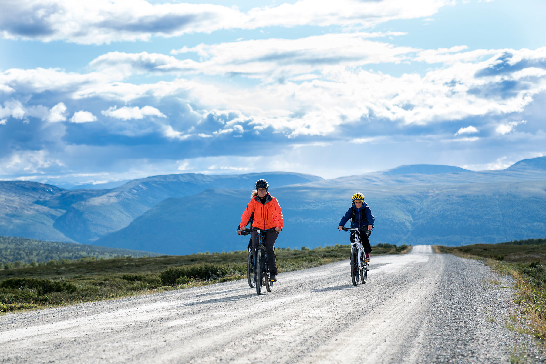
Information about the Tour de Dovre Route
Choose Your Own Adventure
The whole round trip is 125 km long. We have divided the route into stages to give you a clearer picture of the journey. However, you are free to plan your trip according to your preferences, including where you want to spend the night. Feel free to take detours along the way to discover even more.
Tour de Dovre – The Stages
-
Dombås–Hjerkinn
Etappelengde: 30 kilometer
Stigning: 316 høydemeter
Tips! De hardeste motbakkene kommer i starten fra Dombås. Ikke bruk opp all energien fra start.
-
Hjerkinn–Grimsdalshytta
Etappelengde: Ca 57 kilometer
Stigning: 293 høydemeter
Tips! I Grimsdalen er det et rikt dyreliv, med beitedyr og ville dyr. Vis hensyn til natur og dyr.
-
Grimsdalshytta–Dovre
Etappelengde: Ca 30 km
Stigning: 242 høydemeter
Tips! Bruk etablerte teltplasser. Bruk toalett hos Grimsdalshytta eller utedoene som står langs rasteplassene.
-
Dovre–Dombås
Etappelengde: Ca 12 kilometer på begge rutene
Stigning: 179 høydemeter
Tips! Utforsk gjerne flere avstikkere mellom Dovre og Dombås. Her finner du mange spennende turer både til fots og på sykkel.
Map and more information about the route
-

Dombås-Hjerkinn
If you start from Dombås town centre, follow the footpath to Trolltun Gjestegård. From there, you can continue along the National Park Trail (Nasjonalparkvegen), a dedicated gravel path for hikers and cyclists running parallel to the E6 motorway, with no motor traffic allowed.
When you reach Hjerkinn, you cycle a few hundred meters along county road 29, before the route continues along Kvitdalsvegen from Hjerkinn Fjellstue og Fjellridning.
-

Hjerkinn–Grimsdalshytta
Follow county road 29 to Folldal. When you come down to Borkhus, you can choose asphalt along county road 29, or the slightly quieter side road Baksidevegen. Baksidevegen runs along the river on the west side between farms and fields.
From Folldal, follow the asphalted National Tourist Road / County Road 27 to Grimsdalsvegen and to Grimsdalshytta.
On busy roads, the Road Traffic Act §3 applies
-

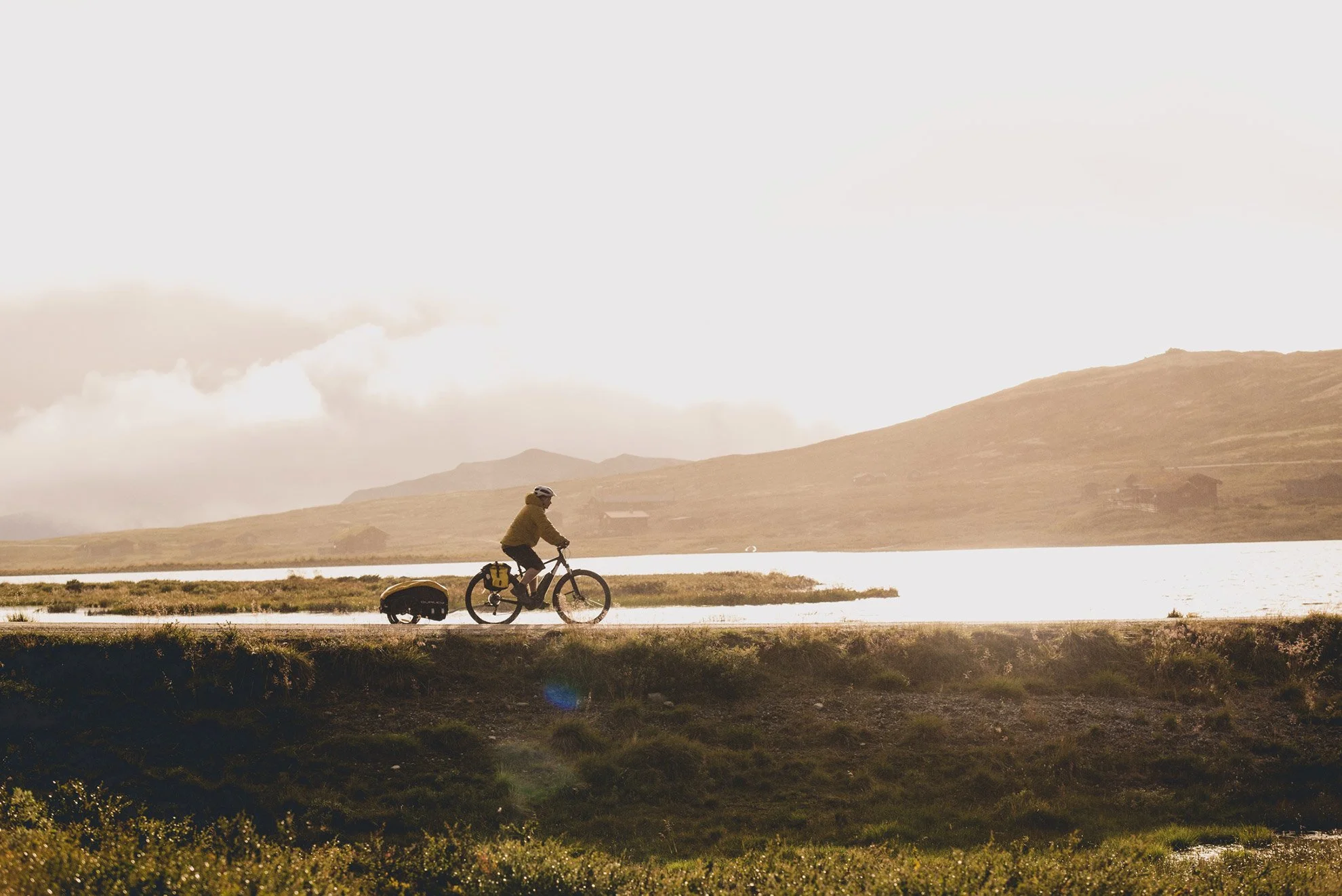
Grimsdalshytta – Dovre
The journey through Grimsdalen is truly spectacular. Cycling along the gravel road offers panoramic views into Rondane. Grimsdalen is an active alpine pasture valley, with the river Grimsa winding beautifully through it.
There are many great spots to take short or longer breaks. Outdoor toilets are available at the mountain campsite near Grimsdalshytta, as well as at Pundarvangen.
From the gate at Eftansåe, it’s downhill all the way to Dovre town centre. You can follow the pedestrian path to Toftemo Turiststasjon, or take Solsidevegen to Dombås.
Please use established campsites for pitching tents.
Make use of the toilets at Grimsdalshytta or the outdoor toilets located at the rest areas.
-
Dovre – Dombås
From Dovre to Dombås, you can cycle along Solsidevegen (County Road 491). This road branches off just before you reach Dovre town centre coming from Grimsdalen. You follow the county road until you reach the E6, and from there, a pedestrian path leads you the final stretch into Dombås town centre.
From Toftemo, you can also cycle via Solsidevegen, or choose Baksidevegen (County Road 497), which continues from Toftemo. Both routes are paved side roads running parallel to the E6 and offer many beautiful spots along the way. Baksidevegen features a steep uphill climb before reaching Dombås town centre.
More info at Ut.no
The Tour de Dovre is also described on Ut.no (Norwegian only). If you can't find the answer to your question, please feel free to contact us. The accommodations are also happy to answer questions about the tour and our beautiful mountain areas!

FAQ
Frequently asked questions about Tour de Dovre.
-
You can rent a bike and have it driven to your desired starting point. Read more about renting here
-
The entire Tour de Dovre is clearly marked. Look for the cycling logo on the green hiking signs! The National Park Road is clearly marked between Trolltun at Dombås and Hjerkinn.
-
The Tour de Dovre is recommended for both summer and autumn trips. Even if the weather is warm, you should bring woolen underwear, outerwear that can withstand rain and wind, a hat and mittens. Summer in the mountains can offer a lot of different weather.
You can get cold faster on your hands, face and feet on a bike than if you were walking.
-
Feel free to fill your water bottle with fresh mountain water. When doing so, choose larger streams or rivers. Always follow local advice regarding drinking water, as at certain times it may be recommended to avoid drinking from small mountain streams.
-
Most of the Tour de Dovre follows dedicated hiking and cycling paths.
However, always remember the rules for cycling in traffic: ride on the right-hand side of the road and keep right when meeting others. Do not cycle under the influence of alcohol or drugs. Always wear a helmet, and use a reflective vest or similar visibility gear.
Your bicycle must be equipped with:
A white or yellow front light
A red rear light
A red rear reflector
Reflectors on the pedals
Two brakes that operate independently
A bell
On busy roads, the Norwegian Road Traffic Act §3 applies.
-
Remember that whatever you bring with you should be taken out again.
Take your rubbish with you and dispose of it in bins or containers along the route. Nature also benefits if you pick up a little extra litter left behind by others.
-
Remember to bring a puncture repair kit and any necessary spare equipment. Check that your bike and other gear are in good condition before setting off on a long ride. If you run into serious trouble, the nearest assistance is available at Sport 1 Holum Sportsservice in Dombås.
-
Everyone needs to answer nature’s call—but please try to avoid heading for the nearest bush. It makes the experience much more pleasant for those who come after you!
Use toilets at accommodation and dining establishments whenever possible. There are also toilets at several rest areas along the route; please refer to the map for locations.
-
There is mobile coverage along most parts of the route, except for Grimsdalen, Kvitdalen, and some shorter sections. Some of the detours also have no mobile coverage.
-
We assume you’re already wearing your bike helmet! Also, bring some basic first aid supplies in your backpack. In addition to plasters, sports tape, blister plasters, and a reflective vest, a windbreaker or emergency blanket can be very useful.
-
What makes the Tour de Dovre unique is the route between three beautiful national parks. While there is freedom to travel on foot within national parks, please note that some protected areas along the route (such as Fokstumyra Nature Reserve) have restricted access during certain times of the year.
Cycling is generally not allowed inside national parks, but it is permitted on certain road sections.
Always show respect for nature and wildlife.
Learn more about Dovrefjell-Sunndalsfjella National Park.
Learn more about Rondane and Dovre National Parks.
-
It is possible to fly drones for photography along certain sections of the route. However, parts of the Tour de Dovre pass through landscape protection areas where flying drones is not allowed without special permission.
Make sure to familiarize yourself with where drone flights are permitted by checking the Civil Aviation Authority’s website. You can also see maps of approved flying zones at Safetofly.no.